


Zell Voting District, Ste. Genevieve County, Missouri
About
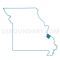
Outline

Summary
| Unique Area Identifier | 609708 |
| Name | Zell Voting District |
| County | Ste. Genevieve County |
| State | Missouri |
| Area (square miles) | 49.69 |
| Land Area (square miles) | 49.50 |
| Water Area (square miles) | 0.18 |
| % of Land Area | 99.63 |
| % of Water Area | 0.37 |
| Latitude of the Internal Point | 37.96625980 |
| Longtitude of the Internal Point | -90.12904040 |
Maps


Graphs
Select a template below for downloading or customizing gragh for Zell Voting District, Ste. Genevieve County, Missouri


Neighbors
Neighoring Voting District (by Name) Neighboring Voting District on the Map
- Bloomsdale Voting District, Ste. Genevieve County, MO
- New Offenburg Voting District, Ste. Genevieve County, MO
- Ozora Voting District, Ste. Genevieve County, MO
- PRAIRIE-DU-ROCHER Voting District, Randolph County, IL
- River Aux Vases Voting District, Ste. Genevieve County, MO
- Ste. Genevieve 5 Voting District, Ste. Genevieve County, MO
Top 10 Neighboring County Subdivision (by Population) Neighboring County Subdivision on the Map
- Ste. Genevieve township, Ste. Genevieve County, MO (8,991)
- Jackson township, Ste. Genevieve County, MO (3,616)
- Beauvais township, Ste. Genevieve County, MO (1,789)
- Prairie du Rocher precinct, Randolph County, IL (974)
Top 10 Neighboring Place (by Population) Neighboring Place on the Map
Top 10 Neighboring Elementary School District (by Population) Neighboring Elementary School District on the Map
Top 10 Neighboring Secondary School District (by Population) Neighboring Secondary School District on the Map
Top 10 Neighboring Unified School District (by Population) Neighboring Unified School District on the Map
Top 10 Neighboring State Legislative District Lower Chamber (by Population) Neighboring State Legislative District Lower Chamber on the Map
- State House District 116, IL (110,789)
- State House District 106, MO (38,873)
- State House District 104, MO (35,833)
Top 10 Neighboring State Legislative District Upper Chamber (by Population) Neighboring State Legislative District Upper Chamber on the Map
Top 10 Neighboring 111th Congressional District (by Population) Neighboring 111th Congressional District on the Map
Top 10 Neighboring Census Tract (by Population) Neighboring Census Tract on the Map
- Census Tract 9601, Ste. Genevieve County, MO (6,342)
- Census Tract 9602, Ste. Genevieve County, MO (4,989)
- Census Tract 9603, Ste. Genevieve County, MO (4,064)
- Census Tract 9509, Randolph County, IL (3,598)
- Census Tract 9604, Ste. Genevieve County, MO (2,750)